To make it easier for the traveler to find and explore Ruboni village and the Rwenzori mountains destination, Ruboni Community Conservation and Development Program (RCCDP) will map all the active and potential tourist attractions in this village. The village is located in the buffer of Rwenzori Mountains National Park.
Ruboni Community Conservation and Development Program (RCCDP) is a community-based organization whose mission is to encourage local community participation in environment conservation to benefit the local community through sustainable development. RCCDP was started in 1998 and has a membership of 50 people (35 women and 15 men)
Population increase directly leads to reducing the natural resource base. Likewise, in the 1990s Ruboni village’s population started increasing rapidly. When this happened, the local people started experiencing increasing poverty. This inspired the creation of RCCDP, by mobilizing community households through tree planting, skills training, communal work, soil and water conservation, and alternative household income enhancement.
Until now, RCCDP is engaged in tourism and using it as a vehicle for generating resources to support conservation and local community development, by innovating sustainable livelihoods aimed at empowering the local population.
It is under this spirit of sustainable livelihoods enhancement that RCCDP has partnered with stakeholders to add Ruboni tourism attractions to the Open Street Map. In return, this mapping initiative is aimed to improve the Ruboni village tourism enterprise’s performance that will in return, economically empower the residents of Ruboni village.
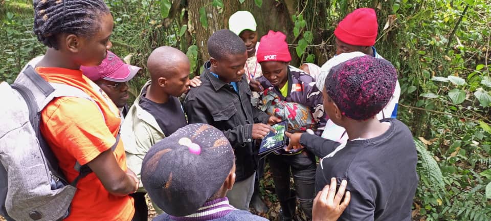
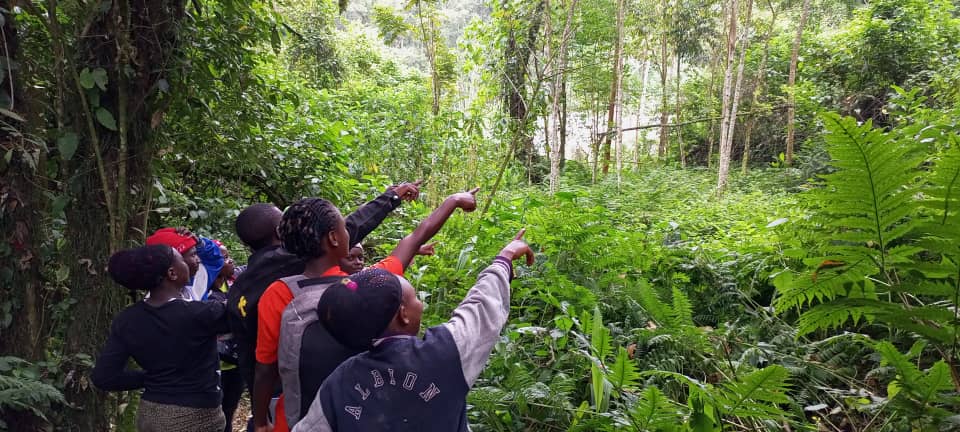
This mapping project will run for one year ending in May 2023. At the end of the project, it will be easy for the tourists to find and explore Ruboni village. as a result of the project, we will have a digital interactive map of the village, a map uploaded to at least ten different tourism online platforms, hard copies of printed maps, and a team of local Mappers with the skill and knowledge to continuously contribute by mapping and updating the content on Open Street Map.
RCCDP activities serve the local people beyond Ruboni village, covering Ibanda-Kyanya Town Council, Bugoye, and Maliba Sub counties. The project is being supported by Humanitarian OpenStreetMap Team (HOT) and is being implemented with local tourism partners.
The implementing partners include; the Uganda community tourism Association (UCOT), Ibanda-Kyanya Town council, and the Kasese district local government. The UNWTO best tourism villages program is the owner and moderator of the upgrade program that inspires and is directly linked to this mapping activity.
To share the excitement with us, you can follow us on our social media handles to learn about the status of the project and possibly know how you can grab a copy of our map whenever it is ready.